Description
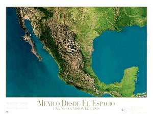
NOAA meteorological satellites provided the data and photography to create this map, which has been further enhanced by the addition of natural colors. The photo mosaic is made up of more than twenty satellite images.
It's possible to distinguish the temperatures of the oceans in this image; lighter colors represent higher temperatures. It's also possible to distinguish the desert and forested areas of Mexico.
A portion of the publisher's profits from the sales of this map go to educating the public about environmental threats to our planet.
 As Seen On TV