No Products in the Cart
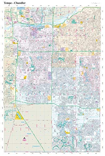
This completely updated color full detail wall map was prepared with digital accuracy and displays impressively on any wall. An excellent tool for any business needing a detailed view of the central corridor. The map's boundaries are Baseline Road on the north, Hunt Highway on the south, 40th Street on the west, and Gilbert Road on the east.
This 1:40,000-scale map shows freeways & expressways, under construction freeways & expressways, Interstate highways, U.S. highways, state highways, county highways, Native America Indian routes, exit numbers, mobile home parks, private access gates, trailheads, METRO light rails & stations, PHX Sky Train & stations, undeveloped streets, major canals, dikes & levees, address alignment numbers, and much, much MORE!
Dry Erase Lamination is a specialty laminate that allows for dry erase markers to be used on the finished print and erased as desired. This dry erase laminated map can be marked up with dry erase markers, sticker dots and arrows, or graphic tape for locations, areas, and zones.
Dry erase laminated, one-sided wall map.
Size: 36" × 48"
 As Seen On TV