
United States Department of the Interior
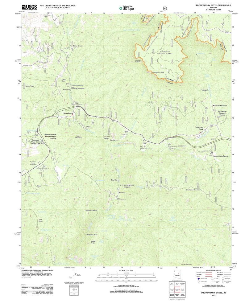
Promontory Butte, Arizona (US Topo 7.5'×7.5' Topographic Quadrangle) [Map] U.S. Geological Survey
$ 12.95
$ 20.95
USGS TNM UST 7.5 - minute quadrangle map for Promontory Butte, AZ:
- Scale: 1:24,000
- Content: Contours; US Topo
- Version Date: 01/01/2011
- Regions: AZ
- Countries: USA
- Latitude: 34° 15' 0" N to 34° 22' 30" N
- Longitude: 111° 7' 30" W to 111° 0' 0" W
- Media: Paper
- Format: Flat
- Historical Reproduction: Yes
- Description: United States Geological Survey Promontory Butte, Arizona The National Map 7.5×7.5 Grid 24000-Scale US Topo 2011
- Survey Date: 2011
- Print Date: 2011
- Height In Inches: 29.000
- Width In Inches: 22.750
- Boundary Type: Quadrangle
- UTM Grid: Grid
- Horizontal Datum: North American 1983 (NAD83)
- Vertical Datum: National Geodetic 1988
- Two-Sided: No
- Plates: 1
- Pieces: 1
- Languages: English